
The Royal Navy has revealed that an uninhabited island has been left incorrectly marked on the map for 85 years.
The finding was made while the navy was performing worldwide checks and updates on British Overseas Territories.
On Thursday evening, March 10, the HMS Spey confirmed that the location of the remote island – located in the Pacific Ocean – had been left wrongly marked on the map for 85 years.
.png)
Henderson Island is one of four volcanic islands in the southern Pacific Ocean that make up the Pitcairn Islands.
Advert
New images of the islands were created using radar and GPS satellites, and when compared to existing charts, the island's exact position did not match up, Sky News reports.
The findings revealed that since 1937, sailors have been using a map that incorrectly labelled Henderson Island as being a mile north of where it truly resides.
In light of the revelation, Lieutenant Michael Royle explained: 'In theory, the image returned by the radar should sit exactly over the charted feature – in this case, Henderson Island. I found that wasn't the case – the radar overlay was a mile away from the island, which means that the island was plotted in the incorrect position when the chart was first produced.
'The notes on the chart say that it was produced in 1937 from aerial photography, which implies that the aircraft which took the photos was slightly off in its navigational calculations.'
New Zealand is located 3,200 miles (5,149km) southwest of the Pitcairn Islands, with Chile being 3,600 miles (5,793km) to the east.
Advert
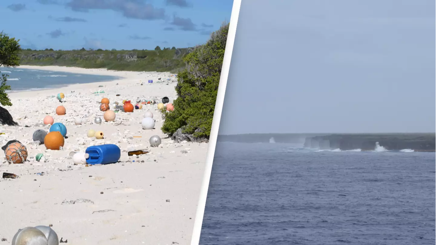
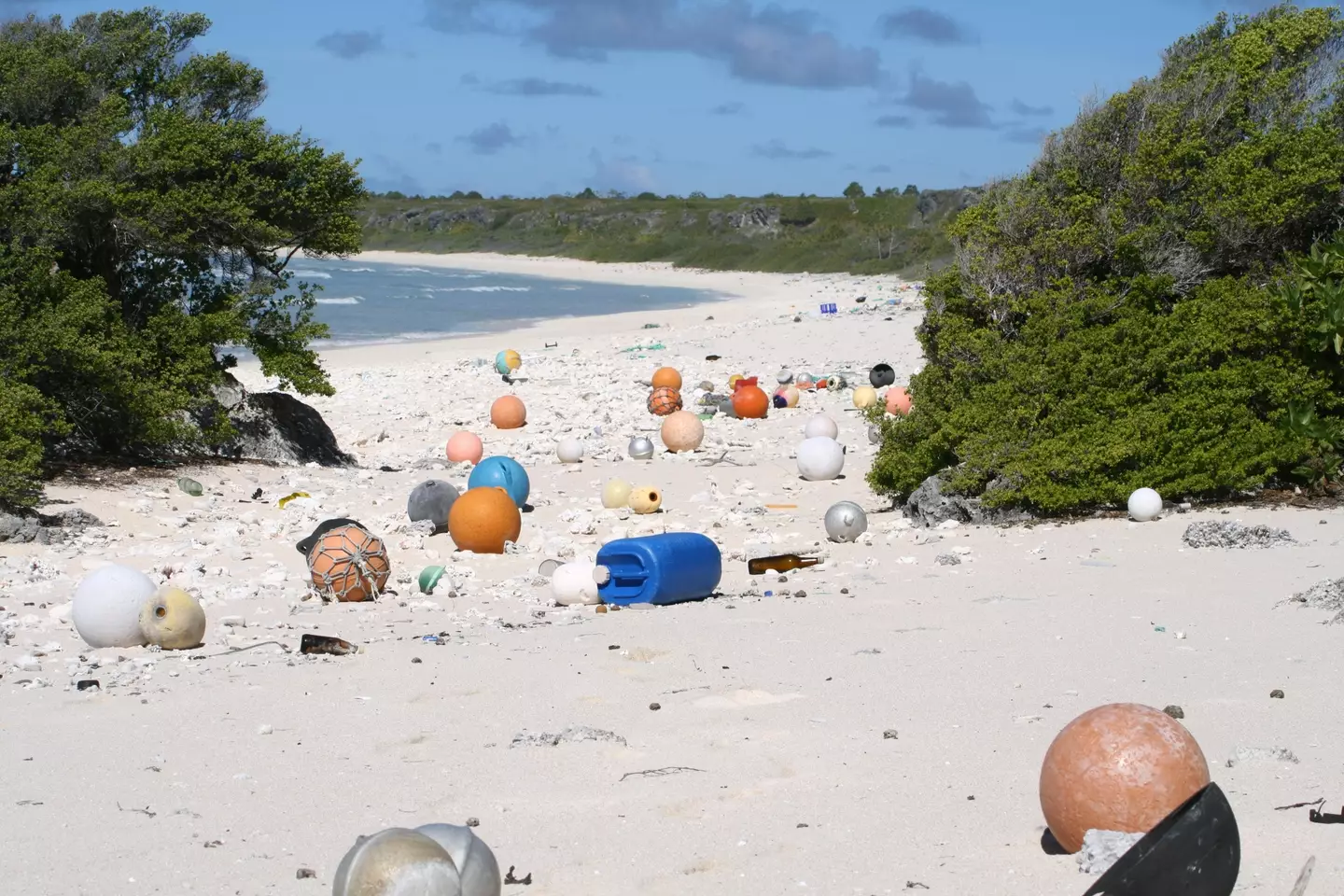
Despite being labelled incorrectly on the map, Henderson Island was last visited in 2018.
In a bid to assess the impact of plastic waste on the ocean, HMS Montrose conducted an environmental survey.
The results concluded that Henderson Island – which is roughly the size of Oxford – is currently the 'most polluted island in the world' due to debris being swept up and dumped onto its shoreline by the Pacific Ocean. Around 270 objects are reported as ending up littered on its beaches each day.
If you have a story you want to tell, send it to UNILAD via [email protected]
Topics: Military