Baffled Google Earth users have been left with more questions than answers after stumbling upon what looks to be a giant 'ice ship' in Antarctica.
Between 'UFOs' and 'hollow islands', our little planet is home to all sorts of unusual sights.
It would be near impossible to see all of them in person, but Google Earth allows us to travel far and wide without ever leaving our sofas, and it's through this handy tech that some explorers found themselves with a birds-eye view of Antarctica.
Advert
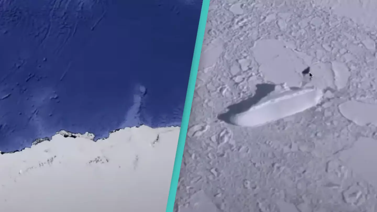
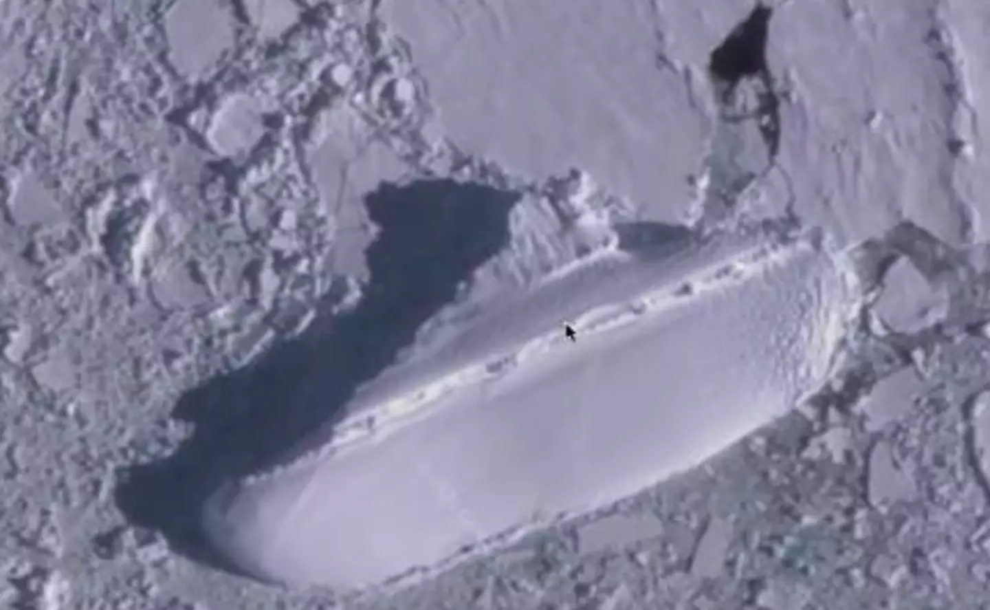
Considering it's an area famously covered in ice, you might not expect there be much to see in Antarctica. But a video published in 2020 proves that theory wrong, as YouTube user MrMBB333 highlighted a large, icy mass in the shape of a boat.
In the clip, the YouTuber uses Google to determine that the 'ship' measured more than 400 feet in length, with shadows indicating that it rose up higher than the land around it.
MrMBB333 put the map into 3D view to get a better view of the shape, saying: "You look down on it and it looks like the outline of a ship. This measures 400ft long, whatever that looks like it looks like a ship..
Advert
"An ice ship if you want to call it – a 400ft yacht just sitting there off the coast of Antarctica."
If you're keen to see the shape for yourself, you can do so on Google Maps using the coordinates 66°54'18.0"S 163°13'37.0"E. But with Antarctica virtually uninhabited, could it really be a ship? And if so, how did it get there?
These are the questions internet users have been left with after watching the video, which Snopes has confirmed is undoctored.
"Has the ice receded in the area where the 'ship' is? Just saying it could be receding ice revealing ship wreaks?," one person suggested.
Another wrote: "That ship probably ended up there from the Bermuda Triangle."
Advert
It's still unclear whether the shape really is a ship, but it's worth noting that ships have sunk in Antarctica in the 21st century.
A Canadian cruise ship named MS Explorer sunk in the continent in 2007, though its last known location was more than 3,000 miles from the icy shape spotted on Google Earth, suggesting it's not responsible for the curiosity online.
In 2013, another ship named Lyubov Orlova was abandoned in Antarctica, but it wasn't nearly as long as the shape spotted on the map.
So, the 'ship' remains a mystery, and until someone can get to Antarctica and explore it for themselves, it's likely to stay that way.
Topics: Google, Technology, Google Maps, YouTube, Viral, Conspiracy Theories